FIRST ALERT WEATHER: Dry until rain returns to the Midlands this weekend
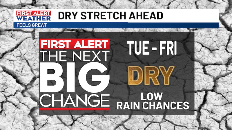
COLUMBIA, S.C. (WIS) - Enjoy this stretch of dry weather before rain arrives for the upcoming weekend.
First Alert Headlines:
- Another nice day ahead!
- Getting warmer for the end of the work week.
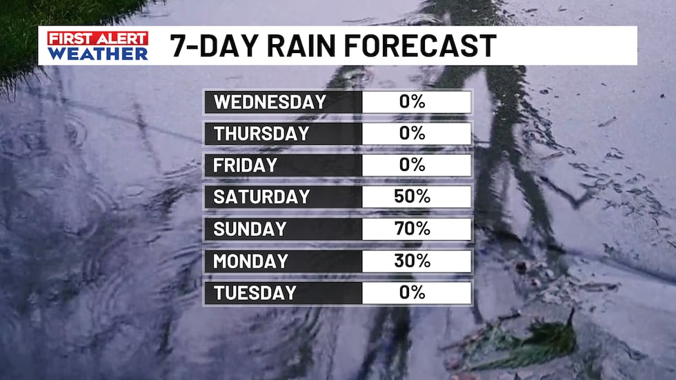
- Rain returns this weekend.
First Alert Summary:
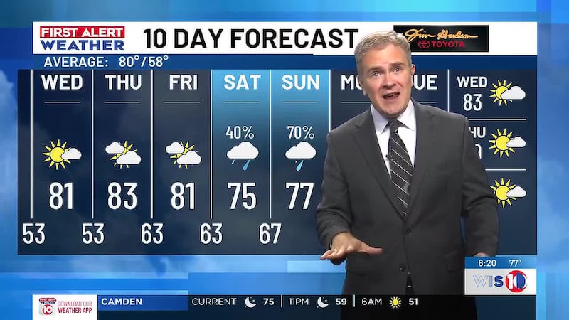
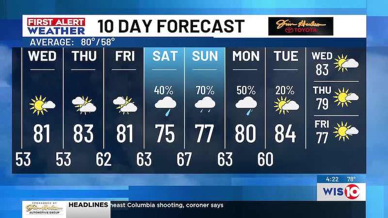
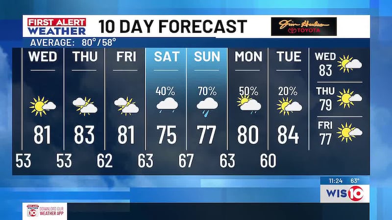
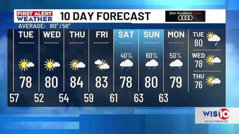
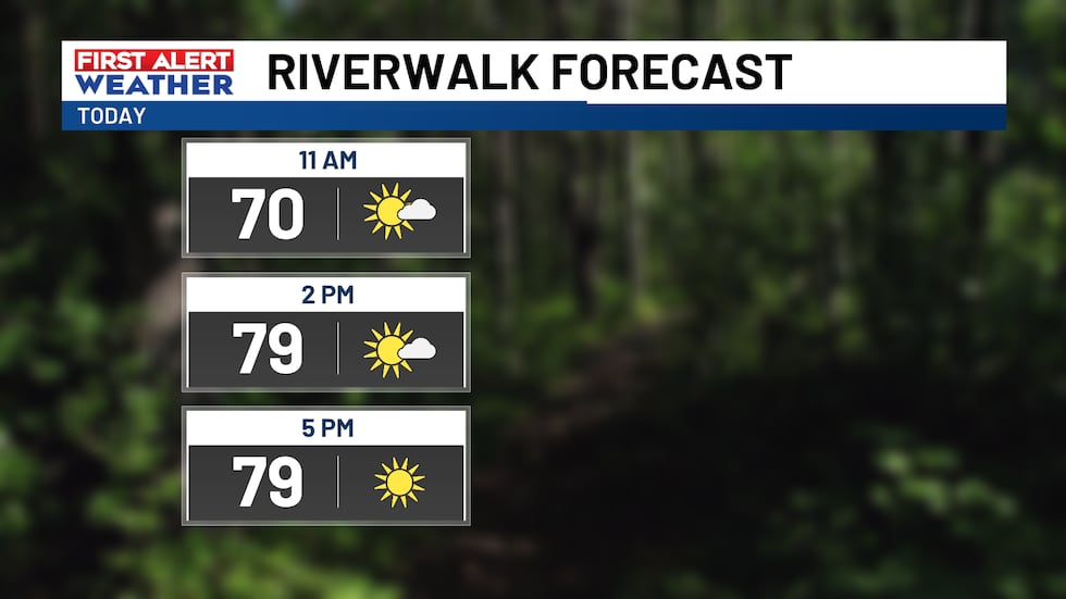
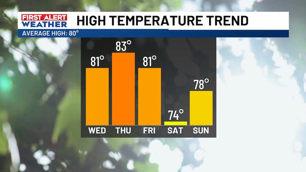
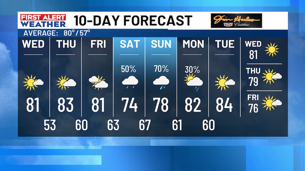
Good morning! High pressure has settled in and is taking control of the forecast for the rest of the work week. After a chilly morning, it’ll warm up fast. Under a mostly sunny sky, high temperatures will reach the low-80s.
Thursday and Friday, it gets a little bit warmer. Although the mornings will remain cool, high temperatures will rebound into the low and mid-80s.
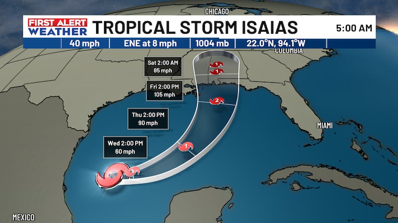
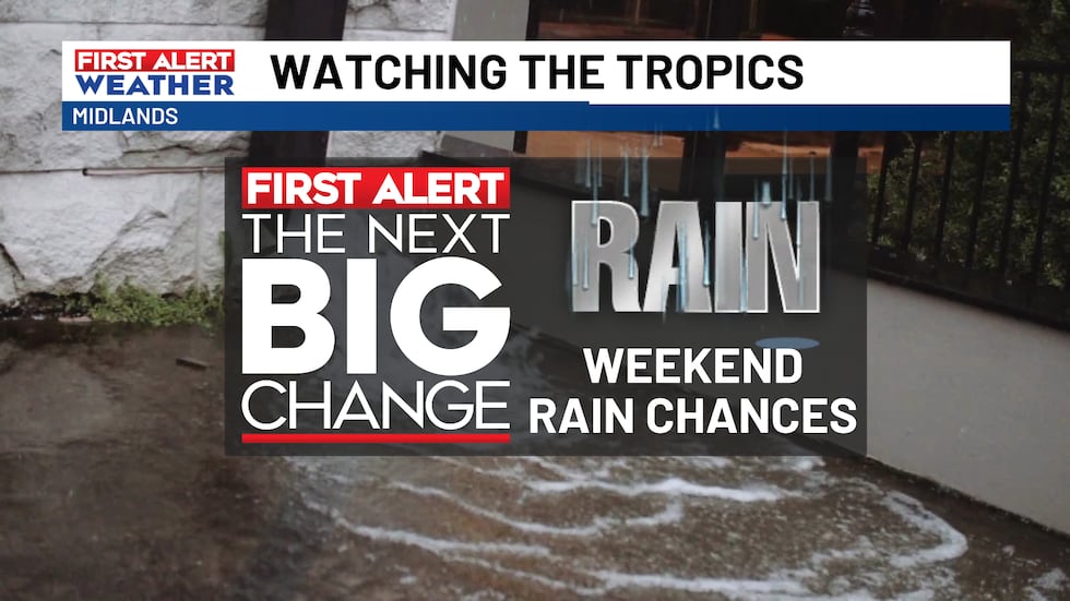
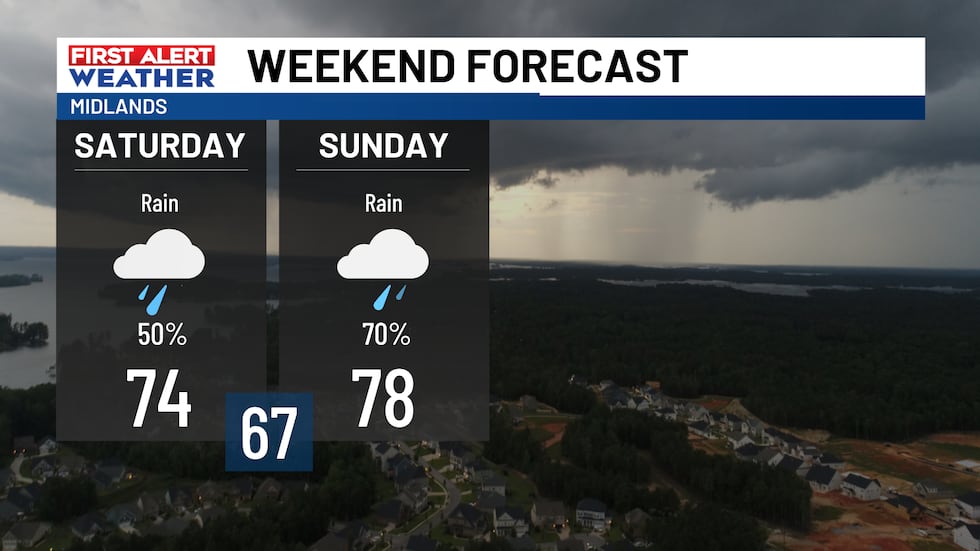
Heading into this weekend, we’re watching Isaias in the Gulf. As it approaches the Gulf Coast, it’ll act as a conveyor belt, bringing moisture into the Midlands. Rounds of rain and gusty winds are expected Saturday and Sunday.
There remains a lot of uncertainty in the weekend forecast because it is highly dependent on the track and strength of Isaias. This will determine the arrival of the rain, how long the rain hangs around, and how much we get. When we know, you’ll know, every step of the way into this weekend.
First Alert Forecast:
Today: Mostly sunny. Highs in the low-80s.
Tonight: Partly cloudy. Lows in the low-50s.
Thursday: Partly to mostly cloudy. Highs in the low and mid-80s.
Friday: Mostly cloudy. Highs in the low-80s.
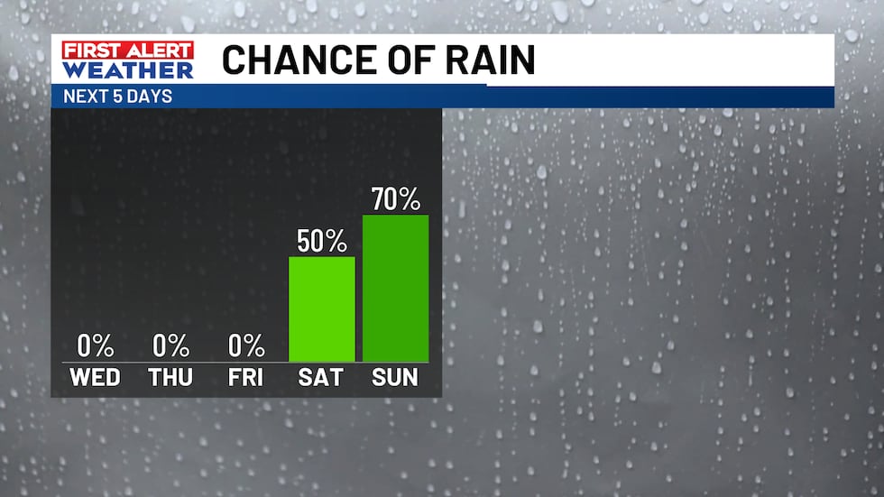
Saturday: Rounds of rain, mainly in the afternoon and evening. Chance of rain 50%. Highs in the mid-70s.
Sunday: Rounds of rain throughout the day, especially in the morning. Chance of rain 70%. Highs in the upper-70s.
Feel more informed, prepared, and connected with WIS. For more free content like this, subscribe to our email newsletter, and download our apps. Have feedback that can help us improve? Click here.
Copyright 2026 WIS. All rights reserved.